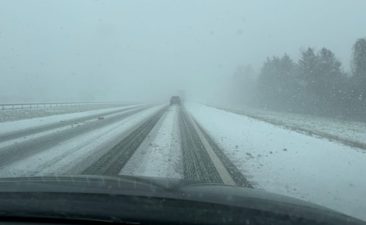
Syracuse, N.Y. -- Snow squalls, which can drop a blinding 1 or 2 inches of snow in a half hour, are possible today in Upstate New York as a cold front blows through and kick-starts the coldest week of the winter so far.
In the Buffalo area, more than a foot of lake effect snow, with wind gusts of 40 to 50 mph, is expected today. The Buffalo Bills wild card playoff game previously scheduled for today has been moved to Monday at Highmark Stadium.
High winds Saturday knocked down trees and wires in several parts of Upstate, particularly Western New York. The damage was much less than Tuesday’s storm that left tens of thousands of people without power.
In Central New York, icy roads contributed to a fatal crash in Marcellus Saturday evening.
Today, snow squalls with wind gusts of 40 to 50 mph are possible from 9 a.m. to 2 p.m. in Central New York and a couple of hours later in the Capital Region and Catskills.
“During any snow squalls, brief whiteout conditions are possible due to the combinations of falling snow and windy conditions,” the weather service said.
Squalls are narrow but fast-moving storms that leave colder temperatures and slippery snow in their wake.
The next chance for snow is Tuesday and Wednesday as another storm tracks up the East Coast. The storm will be too far away to bring any substantial snow, the weather service said, but Central New York could see a few inches.
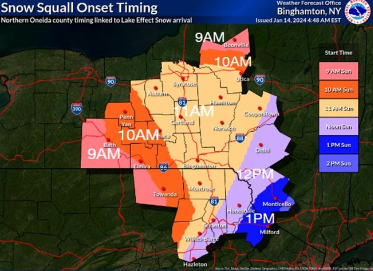
This map shows the approximate time that chances are highest for snow squalls across Central New York.National Weather Service
Temperatures will fall today and into Monday morning as the cold front moves through today. Syracuse could see the coldest day of the year so far on Monday, when temperatures bottom out in the mid-teens. Strong winds will bring the wind chill down close to zero.
It won’t get above freezing for at least the next week, according to weather service forecasts.
Heavy lake effect snow remains in the forecast for Western New York and Tug Hill as southwest winds whip across relatively ice-free Lake Erie and Lake Ontario. In anticipation of that forecast, the National Football League and the Buffalo Bills agreed to move today’s game against the Pittsburgh Steelers to 4:30 p.m. Monday.
A complete travel ban was imposed in Erie County starting at 9 p.m. Saturday because of high winds and lake effect snow.
The strongest gust was 68 mph, recorded at 4:20 p.m. Saturday in the Erie County town of Cheektowaga. The Buffalo airport had a gust of 66 mph just after noon.
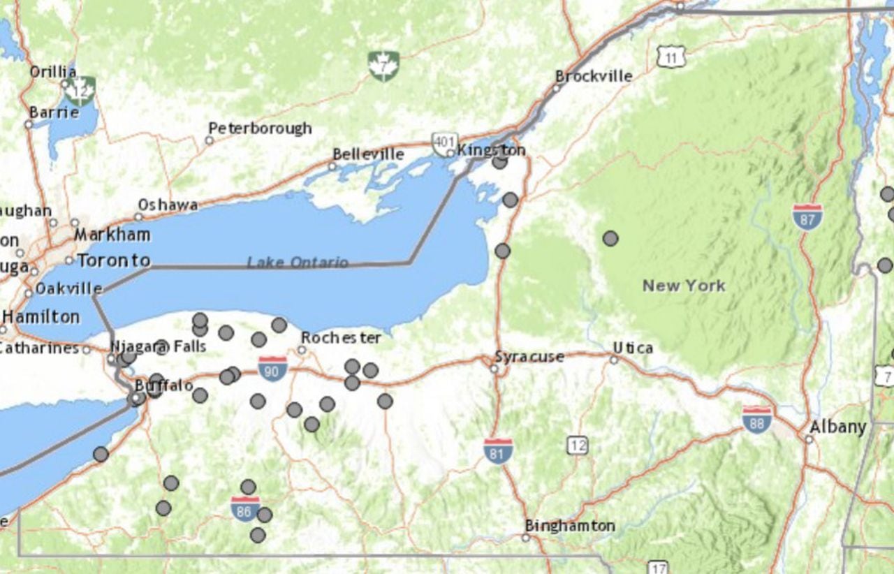
Winds gusting up to 68 mph on Saturday downed trees and wires in Upstate New York, mostly in Western New York and the Finger Lakes. Each gray dot on this map denotes trees or wires down.National Weather Service